
Breaking Down Real Estate Photography Rates: What You Need to Know
- camron246
- Feb 23
- 3 min read
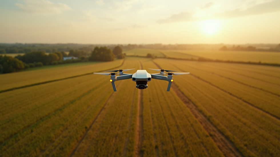
When it comes to showcasing properties in Upstate NY, aerial photography has become an indispensable tool. It offers a stunning perspective that traditional ground shots simply cannot match. But understanding the real estate photography rates and what influences them can be a bit tricky. Today, I’m breaking down the costs involved in real estate aerial photography, helping you make informed decisions that maximize your investment.
Understanding Real Estate Photography Rates
Real estate photography rates vary widely depending on several factors. These include the size of the property, the complexity of the shoot, the equipment used, and the experience of the photographer. In Upstate NY, where landscapes range from sprawling farmland to dense urban areas, these variables play a significant role.
Typically, photographers charge based on:
Property size and type: Larger estates or commercial properties require more time and effort.
Number of photos and videos: More deliverables mean higher costs.
Use of drones and specialized equipment: Aerial shots require drones, which add to the expense.
Post-processing and editing: High-quality editing enhances images but also increases the price.
Travel and logistics: Remote locations or difficult access can add to the cost.
For example, a standard residential shoot might cost between $200 and $500, while commercial or agricultural properties could range from $500 to $1500 or more, especially when aerial shots are involved.

How much to charge for real estate photography?
If you’re a photographer or a business considering offering real estate photography services, setting your rates correctly is crucial. You want to be competitive but also reflect the value and expertise you bring.
Here’s a practical approach to pricing:
Calculate your costs: Include equipment, software, insurance, travel, and your time.
Research local market rates: Understand what others in Upstate NY charge.
Consider your skill level and portfolio: Higher experience justifies higher rates.
Offer tiered packages: Basic, standard, and premium packages cater to different client needs.
Include aerial photography as an add-on: Since drone work requires special skills and permits, it should be priced separately.
For instance, a basic package might include 20 high-quality photos for $300, while a premium package with aerial shots, video walkthroughs, and extensive editing could be $1000 or more.
Factors Influencing Real Estate Aerial Photography Cost
When you’re looking at the real estate aerial photography cost, several specific factors come into play:
Drone type and capabilities: Advanced drones with 4K cameras and obstacle avoidance cost more to operate.
Flight time and complexity: Longer flights or complicated shots require more battery swaps and planning.
Permits and regulations: Compliance with FAA rules and local laws can add administrative costs.
Weather conditions: Poor weather can delay shoots, increasing costs.
Editing and delivery: Aerial images often need specialized editing to correct lighting and perspective.
For example, capturing a sprawling farm with multiple drone passes and detailed editing will cost more than a quick flyover of a suburban home.

Why Investing in Quality Aerial Photography Pays Off
Investing in professional aerial photography is more than just paying for pretty pictures. It’s about gaining a competitive edge in marketing and decision-making. Here’s why it’s worth every penny:
Enhanced property appeal: Stunning aerial shots highlight unique features like landscaping, proximity to amenities, and property size.
Better client engagement: Buyers and investors respond more positively to dynamic visuals.
Accurate property assessment: For agriculture and construction, aerial images provide precise data for planning and monitoring.
Faster sales and higher prices: Properties with professional photos often sell quicker and at better prices.
Brand reputation: Using advanced drone imaging positions your business as innovative and professional.
By choosing a trusted provider like CADi Services in Upstate NY, you ensure you get the best technology and expertise to showcase your property or project.
Tips for Choosing the Right Aerial Photography Service
Selecting the right aerial photography service can make all the difference. Here are some actionable tips to help you choose wisely:
Check credentials and licenses: Ensure the operator is FAA certified and insured.
Review portfolios: Look for quality, style, and relevance to your property type.
Ask about equipment: Modern drones with high-resolution cameras deliver superior results.
Discuss turnaround times: Fast delivery can be critical for marketing timelines.
Clarify pricing and packages: Understand what’s included and any extra fees.
Seek local expertise: Providers familiar with Upstate NY’s terrain and regulations will be more efficient.
By following these guidelines, you’ll find a partner who not only meets your needs but elevates your property’s presentation.
Real estate aerial photography is a powerful tool that can transform how properties are marketed and managed. Understanding the costs involved and what drives pricing helps you make smart choices. Whether you’re in agriculture, construction, or real estate, investing in quality aerial imaging services in Upstate NY is a step toward smarter, more effective business decisions.


Comments