
Maximizing Precision with Precision Mapping Services and Aerial Photogrammetry
- camron246
- May 18
- 4 min read
In today’s fast-paced industries like agriculture, construction, real estate, and infrastructure, precision is everything. Accurate data drives smarter decisions, reduces costs, and accelerates project timelines. One of the most powerful tools at our disposal is aerial photogrammetry, a technology that transforms aerial images into detailed, measurable maps and 3D models. By maximizing precision with precision mapping services, businesses can unlock new levels of insight and efficiency.
Unlocking the Power of Precision Mapping Services
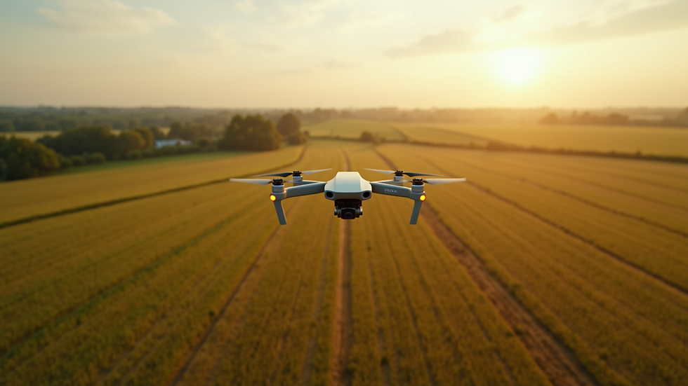
Precision mapping services harness the latest drone technology and advanced software to capture high-resolution aerial images. These images are then processed to create accurate maps and models that reflect real-world conditions with remarkable detail. Whether you’re monitoring crop health, surveying a construction site, or assessing infrastructure, precision mapping delivers actionable data you can trust.
The key to success lies in the quality of data capture and processing. Using drones equipped with high-quality cameras and GPS systems, we collect overlapping images from multiple angles. This overlap is essential for photogrammetry software to stitch images together and calculate precise measurements. The result is a comprehensive, georeferenced map that can be used for analysis, planning, and reporting.
For example, in agriculture, precision mapping can identify variations in soil quality or crop stress, enabling targeted interventions that boost yield and reduce waste. In construction, it helps track progress, verify measurements, and detect potential issues before they become costly problems. Real estate professionals benefit from stunning aerial views and accurate property boundaries, while infrastructure managers can monitor assets and plan maintenance with confidence.

How much does photogrammetry cost?
Understanding the cost of photogrammetry is crucial for budgeting and project planning. The price varies depending on several factors, including the size of the area surveyed, the resolution required, and the complexity of data processing.
Typically, costs break down into:
Flight time and drone operation - Larger areas require longer flights and more battery swaps.
Data processing - High-resolution images and complex models demand more computing power and time.
Specialized services - Additional features like thermal imaging or multispectral analysis can increase costs.
For small to medium projects, prices might range from a few hundred to a few thousand dollars. Larger or more complex projects naturally cost more but offer greater value through detailed insights and risk reduction.
Investing in professional aerial photogrammetry services ensures you get accurate, reliable data without hidden fees or delays. Experienced providers optimize flight plans and processing workflows to deliver the best results within your budget.
Best Practices for Maximizing Precision in Aerial Photogrammetry
Achieving the highest precision requires attention to detail at every stage of the process. Here are some actionable recommendations to maximize accuracy:
Plan your flights carefully: Choose optimal weather conditions with minimal wind and good lighting. Avoid shadows and glare that can distort images.
Ensure sufficient image overlap: Aim for at least 70% forward overlap and 60% side overlap between images. This redundancy helps the software create seamless, accurate models.
Calibrate your equipment: Regularly check and calibrate cameras and GPS units to maintain data integrity.
Use ground control points (GCPs): Mark known locations on the ground with high-precision GPS. These points anchor your model to real-world coordinates, improving georeferencing accuracy.
Select the right software: Use advanced photogrammetry software capable of handling your data volume and complexity. Look for features like automatic error detection and correction.
Validate your results: Cross-check your maps and models against known measurements or survey data to confirm accuracy.
By following these best practices, you can confidently rely on your aerial photogrammetry outputs for critical decision-making.

Applications Driving Business Success in Upstate NY
Upstate New York’s diverse landscape and thriving industries make it an ideal region to leverage precision mapping services. Here’s how businesses in key sectors benefit:
Agriculture: Precision mapping identifies irrigation needs, pest infestations, and crop health variations. This targeted approach saves water, reduces chemical use, and increases yields.
Construction: Regular aerial surveys track site progress, verify earthworks, and support safety inspections. Accurate topographic maps improve planning and reduce rework.
Real Estate: High-resolution aerial imagery enhances property listings and marketing materials. Precise boundary mapping helps resolve disputes and supports development planning.
Infrastructure: Monitoring roads, bridges, and utilities from the air enables early detection of wear and damage. This proactive maintenance approach extends asset life and reduces downtime.
By integrating precision mapping into their workflows, businesses in Upstate NY gain a competitive edge through better data, faster turnaround, and improved project outcomes.
Embracing the Future of Aerial Data Collection
The future of aerial photogrammetry is bright, with continuous advancements in drone technology, sensors, and AI-driven data analysis. As these tools become more accessible and affordable, precision mapping services will play an even greater role in transforming industries.
To stay ahead, consider these emerging trends:
Integration with GIS and BIM: Combining photogrammetry data with Geographic Information Systems (GIS) and Building Information Modeling (BIM) creates comprehensive digital twins for enhanced planning and management.
Real-time data processing: Advances in edge computing allow for near-instant analysis of aerial images, speeding up decision-making.
Multispectral and thermal imaging: These sensors provide additional layers of information, such as plant health or heat loss, expanding the scope of applications.
Automated drone fleets: Autonomous drones can perform regular surveys without human intervention, ensuring consistent data collection.
By embracing these innovations, businesses can maximize precision and efficiency, driving smarter decisions and better results.
Maximizing precision with precision mapping services and aerial photogrammetry is no longer a luxury but a necessity for businesses aiming to thrive in competitive markets. With the right technology, expertise, and approach, you can unlock unparalleled insights and elevate your operations to new heights. Whether you’re managing crops, constructing buildings, marketing properties, or maintaining infrastructure, precise aerial data is your key to success.


Comments