
Transform Mapping with Aerial Photogrammetry and Drone Mapping Services
- camron246
- May 25
- 3 min read
Mapping has evolved dramatically over the past decade, and today, aerial photogrammetry combined with advanced drone mapping services is revolutionizing how businesses gather and analyze spatial data. Whether you are involved in agriculture, construction, real estate, or infrastructure, these technologies offer unparalleled precision and efficiency. I’m excited to share how this transformation can empower your projects with accurate, actionable insights.
Unlocking the Power of Drone Mapping Services
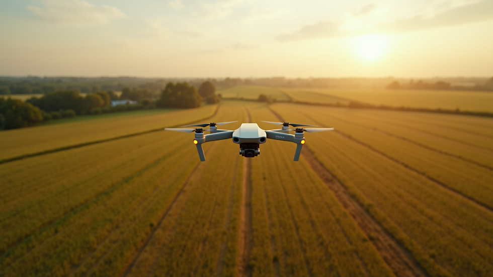
Drone mapping services have become a game-changer for industries that rely on detailed geographic information. Using drones equipped with high-resolution cameras, we can capture thousands of images from multiple angles. These images are then processed to create detailed 3D maps and models of the terrain or structures.
The benefits are clear:
Speed: Drones cover large areas quickly, reducing the time needed for traditional ground surveys.
Accuracy: High-resolution images combined with GPS data produce maps with centimeter-level precision.
Safety: Drones can access hard-to-reach or hazardous areas without putting personnel at risk.
Cost-effectiveness: Compared to manned aircraft or extensive ground surveys, drone mapping is more affordable and scalable.
For example, in agriculture, drone mapping services help monitor crop health, optimize irrigation, and manage fields more efficiently. In construction, they provide real-time site progress updates and help detect potential issues early. Real estate professionals use drone maps to showcase properties with stunning aerial views, while infrastructure projects benefit from precise topographic data for planning and maintenance.
How Aerial Photogrammetry Services Enhance Mapping Accuracy
Aerial photogrammetry is the science of making measurements from photographs taken from the air. When combined with drone technology, it allows us to create highly detailed and accurate maps and 3D models. The process involves capturing overlapping images from different angles, which specialized software then stitches together to generate precise spatial data.
One of the most exciting aspects of aerial photogrammetry is its versatility. It can be used for:
Topographic mapping: Creating detailed elevation models for land development or environmental studies.
Volume calculations: Measuring stockpiles or excavation sites with exact volume data.
Infrastructure inspection: Detecting structural issues in bridges, roads, and power lines.
Land use planning: Assisting urban planners with up-to-date land cover information.
By integrating aerial photogrammetry services into your workflow, you gain access to a wealth of data that supports smarter decision-making. The high level of detail helps reduce errors and rework, saving time and money.

How much does photogrammetry cost?
Understanding the cost of photogrammetry is essential for budgeting your projects effectively. The price depends on several factors, including:
Project size and complexity: Larger areas or more complex terrains require more flight time and data processing.
Resolution and accuracy requirements: Higher precision demands more detailed image capture and processing.
Data deliverables: Whether you need simple orthomosaic maps, 3D models, or detailed analytics affects the cost.
Frequency of surveys: Regular monitoring increases overall expenses but provides ongoing insights.
Typically, photogrammetry services range from a few hundred to several thousand dollars per project. For example, a small agricultural field survey might cost around $500, while a large infrastructure site could exceed $5,000. However, the return on investment is significant when you consider the improved accuracy, reduced labor, and faster project timelines.
To get the best value, it’s important to work with a provider who understands your industry’s specific needs and can tailor the service accordingly.
Practical Applications of Drone Mapping and Photogrammetry in Upstate NY
Upstate New York’s diverse landscape and thriving industries make it an ideal region to leverage drone mapping and aerial photogrammetry. Here are some practical examples of how these technologies can transform your operations:
Agriculture: Monitor crop health with multispectral imaging, identify pest infestations early, and optimize fertilizer application.
Construction: Track site progress with weekly aerial surveys, create accurate as-built models, and improve project management.
Real Estate: Showcase properties with stunning aerial photography and interactive 3D models to attract buyers.
Infrastructure: Inspect bridges, roads, and utilities efficiently, identifying maintenance needs before they become critical.
By integrating these services, businesses in Upstate NY can make data-driven decisions that enhance productivity and reduce costs.
Embracing the Future of Mapping with Confidence
The future of mapping is undeniably aerial and digital. With the combination of drone mapping services and aerial photogrammetry, you gain access to the most advanced tools available for spatial data collection and analysis. These technologies empower you to visualize your projects in new dimensions, uncover hidden insights, and make smarter decisions faster.
If you want to stay ahead in your industry, embracing these innovations is essential. I encourage you to explore how aerial photogrammetry services can elevate your business operations. With precise data, efficient workflows, and expert support, you can transform your mapping processes and achieve outstanding results.
Mapping has never been this exciting or accessible. Let’s take your projects to new heights together.


Comments