
Comprehensive Applications of Precision Aerial Mapping Services
- camron246
- May 4
- 4 min read
In today’s fast-paced industries, having accurate and timely data is crucial for making informed decisions. Precision aerial mapping services have revolutionized how businesses in agriculture, construction, real estate, and infrastructure gather and analyze spatial information. By leveraging advanced drone technology and sophisticated photogrammetry techniques, these services provide detailed, high-resolution maps and 3D models that enhance project planning, monitoring, and management.
Whether you are managing vast farmlands, overseeing complex construction sites, or evaluating real estate properties, precision aerial mapping offers unparalleled insights. In this post, I will walk you through the diverse applications of these services, explain their benefits, and share practical tips on how to integrate them into your operations effectively.
Unlocking the Potential of Precision Aerial Mapping Services
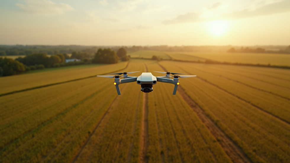
Precision aerial mapping services utilize drones equipped with high-resolution cameras and GPS technology to capture detailed images from above. These images are then processed using photogrammetry software to create accurate maps, orthomosaics, and 3D models. The precision and speed of this method surpass traditional surveying techniques, making it a game-changer for many industries.
For example, in agriculture, precision aerial mapping helps monitor crop health, identify irrigation issues, and optimize fertilizer application. Farmers can detect problem areas early, saving time and resources while boosting yields. In construction, these services provide real-time site progress updates, volume calculations for earthworks, and help ensure compliance with design specifications.

Real estate professionals benefit from stunning aerial visuals that showcase properties from unique perspectives, enhancing marketing efforts and client engagement. Infrastructure projects, such as roadways and bridges, rely on precise mapping to assess conditions, plan maintenance, and improve safety.
By integrating precision aerial mapping services into your workflow, you gain access to detailed spatial data that supports smarter decision-making and efficient project execution.
Diverse Applications Across Key Industries
The versatility of precision aerial mapping services makes them indispensable across several sectors. Let’s explore some of the most impactful applications:
Agriculture
Crop Monitoring: Regular aerial surveys detect variations in plant health, pest infestations, and water stress.
Soil Analysis: Mapping soil types and moisture levels helps optimize planting strategies.
Yield Prediction: Data-driven insights improve forecasting and resource allocation.
Construction
Site Surveying: Rapidly generate topographic maps and 3D models for planning and design.
Progress Tracking: Monitor construction phases with up-to-date aerial imagery.
Volume Measurement: Calculate stockpile volumes and earthmoving quantities accurately.
Real Estate
Property Marketing: Capture breathtaking aerial photos and videos to attract buyers.
Land Assessment: Evaluate terrain and boundaries for development potential.
Environmental Impact: Assess surrounding areas for zoning and regulatory compliance.
Infrastructure
Inspection: Inspect bridges, power lines, and roads safely and efficiently.
Maintenance Planning: Identify wear and damage early to schedule repairs.
Disaster Management: Quickly assess damage after natural events for rapid response.

These examples highlight how precision aerial mapping services provide actionable data that enhances productivity, reduces costs, and improves safety across various projects.
How much does photogrammetry cost?
Understanding the cost of photogrammetry is essential when considering its integration into your business. Pricing varies depending on several factors:
Project Size: Larger areas require more flight time and data processing.
Resolution Requirements: Higher resolution images demand more advanced equipment and longer processing.
Frequency of Surveys: Regular monitoring increases overall costs but provides ongoing benefits.
Complexity: Challenging terrain or specific deliverables like 3D models may add to expenses.
On average, small to medium projects can range from a few hundred to several thousand dollars. However, the return on investment is significant when you consider the accuracy, speed, and insights gained. Many providers offer customized packages tailored to your specific needs, ensuring you only pay for what you require.
To get the best value, I recommend discussing your project goals with a trusted provider who can help design a cost-effective solution. Remember, investing in precision aerial mapping services often leads to savings by preventing costly errors and optimizing resource use.
Integrating Aerial Photogrammetry Services into Your Workflow
To maximize the benefits of aerial photogrammetry services, it’s important to adopt a strategic approach. Here are some actionable recommendations:
Define Clear Objectives: Identify what you want to achieve with aerial mapping - whether it’s monitoring crop health, tracking construction progress, or assessing property conditions.
Choose the Right Provider: Look for a service provider with experience in your industry and region. Local knowledge ensures compliance with regulations and better understanding of your needs.
Plan Flight Schedules: Coordinate drone flights to capture data at optimal times, such as during specific crop growth stages or construction milestones.
Leverage Data Analytics: Use software tools to analyze maps and models, extracting meaningful insights that inform decisions.
Train Your Team: Ensure your staff understands how to interpret aerial data and integrate it into daily operations.
By following these steps, you can seamlessly incorporate aerial photogrammetry into your projects, enhancing accuracy and efficiency.
Future Trends and Innovations in Aerial Mapping
The field of precision aerial mapping is evolving rapidly, driven by technological advancements and growing demand. Here are some exciting trends to watch:
Artificial Intelligence: AI-powered analysis automates feature detection and anomaly identification, speeding up data interpretation.
Multispectral Imaging: Beyond visible light, drones equipped with multispectral sensors provide deeper insights into vegetation health and material properties.
Real-Time Data Streaming: Live aerial data feeds enable immediate decision-making on-site.
Integration with BIM: Combining aerial maps with Building Information Modeling enhances construction planning and asset management.
Swarm Drones: Coordinated drone fleets can cover large areas faster and more efficiently.
Staying informed about these innovations will help you leverage the latest tools to maintain a competitive edge and deliver superior results.
Elevate Your Projects with Precision Aerial Mapping
Harnessing the power of precision aerial mapping services transforms how you approach agriculture, construction, real estate, and infrastructure projects. The detailed spatial data and high-quality visuals empower you to make smarter decisions, optimize resources, and improve outcomes.
By partnering with a reliable provider, you gain access to cutting-edge drone technology and expert analysis tailored to your unique needs. Whether you aim to boost crop yields, streamline construction workflows, or enhance property marketing, aerial photogrammetry services offer a comprehensive solution.
Embrace this innovative approach today and watch your projects soar to new heights with precision, efficiency, and confidence.


Comments