
Exploring Mavic 3T Thermal Imaging in Albany
When it comes to harnessing cutting-edge technology for aerial imaging, the Mavic 3T thermal imaging drone stands out as a game-changer. Its advanced thermal capabilities open new doors for businesses in agriculture, construction, real estate, and infrastructure across Upstate New York. In Albany, this technology is transforming how professionals gather data, monitor assets, and make informed decisions. I’ve had the opportunity to explore the Mavic 3T’s thermal imaging features firsthand, and I’m excited to share insights on how it can elevate your operations.
Unlocking the Power of Mavic 3T Thermal Imaging
The Mavic 3T is not just another drone; it’s a sophisticated tool designed to capture thermal data with remarkable precision. Thermal imaging allows you to see heat signatures invisible to the naked eye, which is invaluable for detecting issues early and improving efficiency.
For example, in agriculture, thermal imaging helps identify irrigation problems by highlighting dry patches or stressed crops. In construction, it reveals heat loss in buildings or overheating equipment, enabling timely maintenance. Real estate professionals can use it to inspect properties for insulation quality, while infrastructure managers can monitor electrical systems and pipelines for faults.
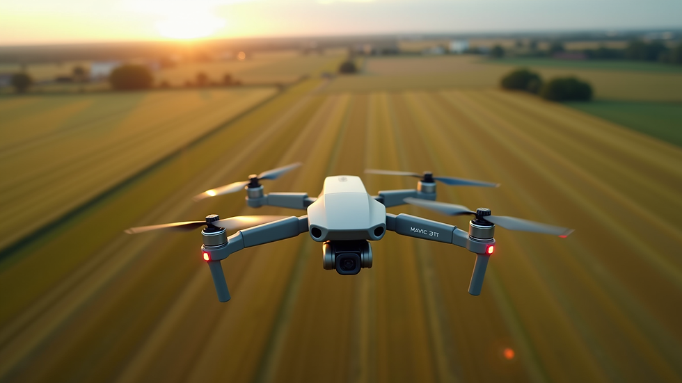
The Mavic 3T’s dual-camera system combines a high-resolution RGB camera with a thermal sensor, providing comprehensive visual and thermal data in one flight. This integration means you get detailed images and temperature readings simultaneously, streamlining your inspection process.
Practical Applications of Mavic 3T Thermal Imaging in Albany
Albany’s diverse landscape and industries make it an ideal place to leverage the Mavic 3T’s capabilities. Here are some practical ways this technology is making a difference:
Agriculture: Farmers can monitor crop health, detect pest infestations early, and optimize irrigation schedules. Thermal imaging pinpoints areas where water stress or disease may be affecting yields, allowing for targeted interventions.
Construction: Project managers use thermal scans to assess building envelopes, detect moisture intrusion, and verify HVAC system performance. This reduces costly rework and ensures projects meet energy efficiency standards.
Real Estate: Agents and inspectors can provide clients with detailed thermal reports that highlight insulation issues or hidden damage, adding value to property evaluations.
Infrastructure: Utility companies and municipal agencies benefit from thermal inspections of power lines, substations, and pipelines, identifying hotspots that signal potential failures before they escalate.
The ability to quickly gather accurate thermal data from hard-to-reach places saves time and enhances safety. Instead of manual inspections that can be risky and time-consuming, the Mavic 3T offers a bird’s-eye view with thermal precision.
How to Maximize Your Use of Mavic 3T Thermal Imaging
To get the most out of the Mavic 3T, it’s essential to understand its features and best practices:
Plan Your Flight Path: Use mapping software to design efficient routes that cover all critical areas. This ensures comprehensive data collection without unnecessary battery drain.
Adjust Thermal Settings: Customize the thermal palette and temperature range to highlight specific issues relevant to your industry. For instance, a “hot” palette works well for electrical inspections, while a “cool” palette may be better for agriculture.
Combine Thermal and Visual Data: Analyze thermal images alongside RGB photos to get a full picture of the site conditions. This dual perspective helps in accurate diagnosis and reporting.
Regular Inspections: Schedule routine thermal surveys to track changes over time. This proactive approach helps catch problems early and supports maintenance planning.
Leverage Software Tools: Use specialized software for thermal image analysis and reporting. Many platforms offer automated anomaly detection and easy-to-understand visualizations.
By following these steps, you can transform raw thermal data into actionable insights that drive smarter decisions and improve operational outcomes.

Why Albany is the Perfect Place for Thermal Imaging Innovation
Albany’s unique combination of urban development, agricultural land, and critical infrastructure creates a fertile environment for adopting advanced drone technology. The region’s businesses are increasingly recognizing the value of precise aerial data to stay competitive and efficient.
Moreover, Albany’s regulatory environment supports responsible drone use, making it easier for operators to conduct thermal imaging flights safely and legally. This encourages innovation and investment in drone services tailored to local needs.
The presence of technology hubs and educational institutions in the area also fosters collaboration and knowledge sharing. This ecosystem helps businesses stay ahead of trends and continuously improve their use of thermal imaging.
For those interested in exploring the benefits of this technology, partnering with a trusted provider who understands the local landscape is key. They can offer tailored solutions that align with your specific industry challenges and goals.
Elevate Your Business with Advanced Thermal Imaging
Incorporating the Mavic 3T into your operations is more than just adopting new technology - it’s about gaining a competitive edge. The precision and efficiency of thermal imaging empower you to:
Detect problems before they become costly repairs
Optimize resource use and reduce waste
Enhance safety by minimizing manual inspections in hazardous areas
Provide clients with detailed, data-driven reports that build trust and credibility
If you’re ready to experience the transformative impact of drone thermal imaging, consider exploring mavic 3t thermal imaging albany. This resource connects you with expert services designed to meet the demands of Upstate New York’s dynamic industries.
By embracing this technology, you position your business at the forefront of innovation, ready to tackle challenges with confidence and precision.
The future of aerial imaging is here, and the Mavic 3T thermal imaging drone is leading the way. Whether you’re managing crops, overseeing construction projects, inspecting properties, or maintaining infrastructure, this technology offers unparalleled insights that drive smarter decisions. Albany’s vibrant business landscape is perfectly suited to benefit from these advancements, making now the ideal time to explore what thermal imaging can do for you.


Comments