
Latest Drone Imaging Trends: Unlocking New Possibilities in Aerial Data
In the fast-evolving world of drone technology, imaging capabilities have taken a giant leap forward. As someone deeply involved in providing advanced drone imaging services, I’m excited to share the latest updates that are transforming how businesses in agriculture, construction, real estate, and infrastructure operate—especially here in Upstate NY. These innovations are not just about capturing stunning visuals; they’re about delivering precise, actionable data that drives smarter decisions and boosts efficiency.
Exploring the Latest Drone Imaging Trends
The drone imaging landscape is buzzing with innovation. From enhanced sensor technology to smarter data processing, the latest drone imaging trends are reshaping aerial data collection. One of the most significant advancements is the integration of multispectral and hyperspectral sensors. These sensors capture data beyond the visible spectrum, allowing for detailed analysis of crop health, soil conditions, and material composition.
For example, in agriculture, multispectral imaging helps identify stressed plants before they are visible to the naked eye. This early detection enables timely interventions, reducing crop loss and improving yields. Similarly, in construction, hyperspectral imaging can detect material inconsistencies or moisture intrusion, preventing costly structural issues.
Another exciting trend is the rise of AI-powered image processing. Artificial intelligence now automates the analysis of vast amounts of aerial data, identifying patterns and anomalies with remarkable accuracy. This means faster turnaround times and more reliable insights for businesses relying on drone imaging.

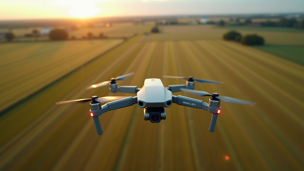
Drone capturing multispectral images over farmland to monitor crop health
How Enhanced Imaging Sensors Are Changing the Game
The heart of drone imaging technology lies in its sensors. Recent improvements have made sensors smaller, lighter, and more powerful. This allows drones to fly longer and capture higher-resolution images with greater detail. The latest sensors offer higher dynamic range and improved low-light performance, which means clearer images even in challenging lighting conditions.
For infrastructure inspections, this is a game-changer. Drones can now capture detailed images of bridges, power lines, and pipelines at dawn or dusk, times when traditional inspections might be limited. The ability to gather high-quality data regardless of lighting conditions ensures more comprehensive assessments and safer operations.
Moreover, thermal imaging sensors have become more accessible and precise. Thermal drones are invaluable for detecting heat leaks in buildings, monitoring electrical equipment, and identifying irrigation issues in agriculture. The combination of thermal and visual imaging provides a fuller picture, enabling businesses to address problems proactively.
Practical Applications Driving Business Success
The practical applications of these latest drone imaging trends are vast and impactful. In real estate, high-resolution 3D mapping and photogrammetry create immersive property tours and accurate site models. This not only enhances marketing efforts but also aids in planning renovations or new developments.
Construction companies benefit from real-time progress monitoring. Drones equipped with advanced imaging sensors can capture daily site updates, track material deliveries, and verify compliance with safety standards. This level of oversight reduces delays and keeps projects on budget.
In agriculture, precision farming is reaching new heights. By combining multispectral imaging with AI analytics, farmers can optimize irrigation, fertilization, and pest control. This targeted approach conserves resources and maximizes output, which is especially valuable in the diverse climates of Upstate NY.

Drone surveying a construction site with high-resolution imaging for progress tracking
Integrating Drone Imaging Into Your Workflow
Adopting the latest drone imaging technology requires thoughtful integration into existing workflows. Here are some actionable recommendations to get started:
Identify Key Use Cases - Determine which aspects of your operations will benefit most from drone imaging. Is it crop monitoring, site inspection, or property marketing?
Choose the Right Sensor Package - Select drones equipped with sensors tailored to your needs, whether that’s multispectral, thermal, or high-resolution RGB cameras.
Leverage AI and Data Analytics - Use software platforms that incorporate AI to analyze images quickly and provide actionable insights.
Train Your Team - Ensure your staff understands how to operate drones safely and interpret the data effectively.
Partner with Experts - Collaborate with experienced drone imaging providers who understand your industry and regional challenges.
By following these steps, businesses can unlock the full potential of drone imaging technology and gain a competitive edge.
Looking Ahead: What’s Next for Drone Imaging?
The future of drone imaging is incredibly promising. We’re on the cusp of seeing real-time 3D mapping become standard, enabling instant visualization of sites and landscapes. Advances in edge computing will allow drones to process data onboard, reducing the need for extensive post-flight analysis.
Additionally, swarm drone technology is emerging, where multiple drones work together to cover large areas quickly and efficiently. This is particularly useful for infrastructure inspections and large-scale agricultural monitoring.
As these technologies mature, they will further empower businesses in Upstate NY to make smarter, faster decisions. Staying informed through resources like the drone imaging blog and updates is essential to keep pace with these exciting developments.
Embracing Innovation for Smarter Decisions
The latest drone imaging trends are more than just technological advancements—they represent a shift in how aerial data supports business growth. By embracing these innovations, companies in agriculture, construction, real estate, and infrastructure can enhance precision, improve efficiency, and reduce costs.
At CADi Services, we are committed to bringing these cutting-edge drone imaging solutions to Upstate NY. Our goal is to help you harness the power of advanced aerial data to make smarter decisions and achieve outstanding results.
If you’re ready to explore how the latest drone imaging technology can transform your operations, now is the perfect time to take the leap. The future of aerial data is bright, and the possibilities are endless.


Comments