
Exploring Professional Drone Mapping Services with Aerial Photogrammetry
- camron246
- Feb 16
- 4 min read
In today’s fast-paced industries like agriculture, construction, real estate, and infrastructure, having accurate and timely data is crucial. That’s where professional drone mapping services come into play. These services harness cutting-edge technology to capture detailed aerial images and transform them into actionable insights. I’m excited to share how these advanced solutions can revolutionize your projects, especially if you’re operating in Upstate NY.
Unlocking the Power of Drone Mapping Services
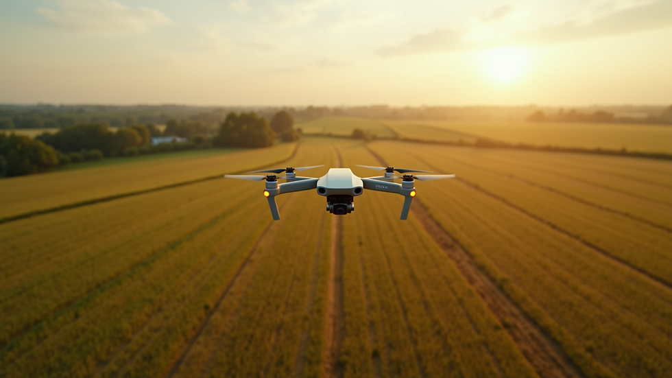
Drone mapping services have become a game-changer for businesses seeking precision and efficiency. Using drones equipped with high-resolution cameras and GPS technology, these services provide comprehensive aerial surveys that cover large areas quickly and safely. Whether you’re managing farmland, overseeing a construction site, or evaluating real estate properties, drone mapping offers unparalleled advantages.
Here’s why drone mapping services stand out:
Speed and Efficiency: Drones can cover vast areas in a fraction of the time it takes traditional survey methods.
High Accuracy: With GPS and advanced sensors, drones capture precise data that supports detailed analysis.
Cost-Effective: Reducing the need for manual labor and expensive equipment lowers overall project costs.
Safety: Drones access hard-to-reach or hazardous locations without putting personnel at risk.
For example, in agriculture, drone mapping helps monitor crop health, identify irrigation issues, and optimize fertilizer use. In construction, it tracks progress, manages materials, and ensures compliance with design plans. Real estate professionals benefit from stunning aerial views that enhance property listings and provide accurate land measurements.

How Professional Aerial Photogrammetry Services Enhance Your Projects
One of the most impressive aspects of drone mapping is the integration of photogrammetry. This technique involves capturing multiple overlapping images from different angles and processing them to create detailed 3D models and maps. By leveraging aerial photogrammetry services, you gain access to precise topographic data, volumetric measurements, and orthomosaic maps that are invaluable for decision-making.
Here’s how aerial photogrammetry services can elevate your operations:
3D Terrain Modeling: Understand land contours and elevation changes for better planning.
Volume Calculations: Accurately measure stockpiles, excavation sites, or material quantities.
Orthomosaic Maps: Generate high-resolution, georeferenced images that serve as reliable base maps.
Change Detection: Monitor site changes over time to track progress or identify issues early.
For instance, infrastructure projects benefit from detailed terrain models that inform road design and drainage planning. Real estate developers can use orthomosaic maps to visualize property boundaries and plan landscaping. These services provide a level of detail and accuracy that traditional methods simply cannot match.

How Much Does Photogrammetry Cost?
Understanding the cost of photogrammetry services is essential for budgeting and project planning. Pricing can vary based on several factors, including the size of the area surveyed, the complexity of the project, and the level of detail required.
Here’s a breakdown of typical cost considerations:
Project Size: Larger areas require more flight time and data processing, increasing costs.
Resolution and Accuracy: Higher resolution images and more precise models demand advanced equipment and longer processing times.
Data Deliverables: Customized outputs like 3D models, orthomosaics, or volume reports may affect pricing.
Location and Accessibility: Remote or difficult-to-access sites might incur additional fees.
On average, small to medium projects can range from a few hundred to a few thousand dollars. However, the return on investment is significant when you consider the time saved, improved accuracy, and enhanced decision-making capabilities.
To get the best value, I recommend working with a trusted provider who offers transparent pricing and tailored solutions. This ensures you receive exactly what you need without unnecessary extras.
Practical Applications Across Key Industries in Upstate NY
The versatility of drone mapping and photogrammetry services makes them ideal for a variety of sectors. Here’s how these technologies are transforming key industries in Upstate NY:
Agriculture: Monitor crop health with multispectral imaging, assess soil conditions, and optimize irrigation schedules. This leads to higher yields and more sustainable practices.
Construction: Track site progress with regular aerial surveys, create accurate as-built documentation, and improve safety by identifying hazards early.
Real Estate: Enhance property marketing with stunning aerial photos and videos, provide precise land measurements, and support zoning or development applications.
Infrastructure: Inspect bridges, roads, and utilities efficiently, detect structural issues early, and plan maintenance with detailed 3D models.
By integrating these services into your workflow, you gain a competitive edge and make smarter, data-driven decisions that save time and money.
Choosing the Right Provider for Your Drone Mapping Needs
Selecting a professional drone mapping service provider is a critical step. You want a partner who understands your industry, offers reliable technology, and delivers actionable results. Here are some tips to help you choose wisely:
Experience and Expertise: Look for providers with a proven track record in your sector and familiarity with local regulations.
Technology and Equipment: Ensure they use the latest drones, cameras, and software for optimal data quality.
Customization: Your projects are unique, so find a provider who tailors services to your specific needs.
Turnaround Time: Timely delivery of data is essential for keeping projects on schedule.
Customer Support: Responsive communication and ongoing support make collaboration smoother.
At CADi Services, we pride ourselves on being Upstate NY’s go-to source for advanced drone imaging. Our team combines technical skill with local knowledge to help you unlock the full potential of aerial data.
Elevate Your Projects with Advanced Drone Imaging Today
Embracing professional drone mapping services opens up a world of possibilities. From detailed 3D models to precise volume measurements, these technologies empower you to make informed decisions and optimize your operations. Whether you’re managing farmland, overseeing construction, or marketing real estate, the benefits are clear.
If you’re ready to take your projects to the next level, consider partnering with a trusted provider who delivers quality, accuracy, and efficiency. With the right aerial data at your fingertips, you’ll gain the insights needed to succeed in today’s competitive landscape.
Explore how professional drone mapping and aerial photogrammetry services can transform your business and help you achieve smarter, faster results. The future of precision data is here - let’s soar to new heights together.


Comments