
Real Estate Drone Photography Cost: Pricing Explained
- camron246
- Mar 2
- 4 min read
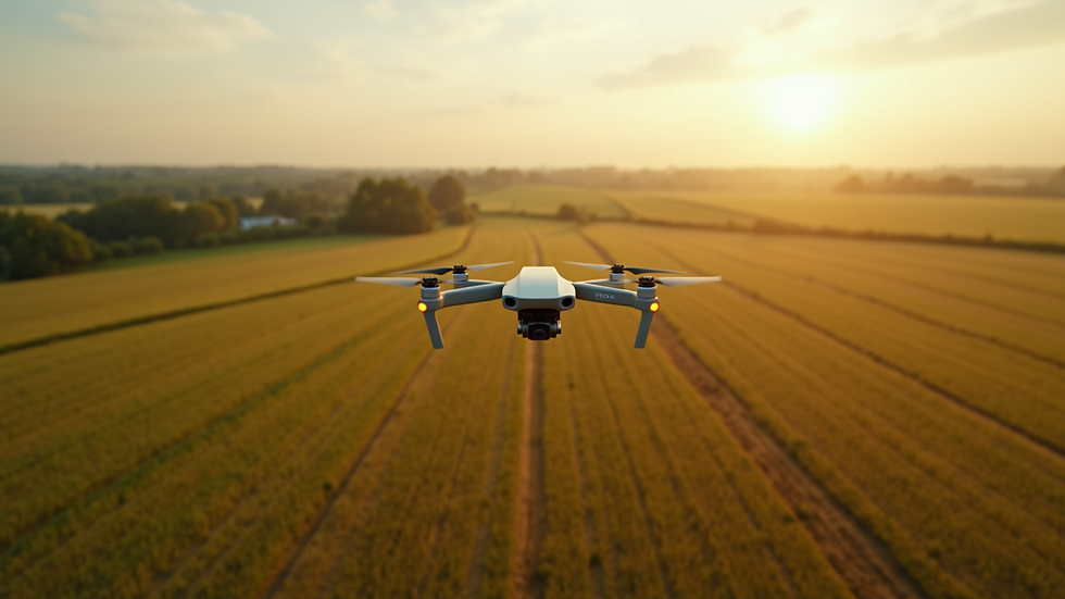
When it comes to showcasing properties in the most captivating way, drone photography has revolutionized the real estate industry. The ability to capture stunning aerial views adds a dynamic perspective that traditional photography simply cannot match. However, understanding real estate drone photography cost can be a bit complex. In this post, I’ll walk you through the key factors that influence pricing, helping you make informed decisions whether you’re hiring a drone photographer or offering these services yourself.
What Influences Real Estate Drone Photography Cost?
Pricing for drone photography in real estate depends on several important factors. Knowing these will help you anticipate costs and budget accordingly.
1. Property Size and Complexity
Larger properties or those with unique features like pools, gardens, or multiple buildings require more flight time and planning. This naturally increases the cost. For example, a small urban condo might only take 15 minutes to shoot, while a sprawling estate or commercial property could take hours.
2. Location and Accessibility
Flying drones in certain areas may require special permits or additional insurance, especially in urban or restricted zones. If the property is in a remote or difficult-to-access location, the drone operator might charge extra for travel and setup time.
3. Flight Time and Number of Shots
The more shots and angles you want, the longer the drone will need to be in the air. This includes capturing both wide aerial views and close-up shots of architectural details. Some photographers offer packages with a set number of images or minutes of flight time.
4. Post-Processing and Editing
Raw drone footage often needs professional editing to enhance colors, correct lighting, and stitch panoramic shots. This post-processing adds value but also increases the overall price.
5. Equipment and Technology
High-end drones with 4K cameras, GPS stabilization, and advanced sensors deliver superior image quality but come with higher operating costs. Photographers who invest in the latest technology may charge more to reflect this.
6. Experience and Reputation
Seasoned drone photographers with a strong portfolio and positive client reviews often command premium rates. Their expertise ensures smooth flights, stunning shots, and compliance with all regulations.

Understanding Real Estate Drone Photography Cost in Detail
To give you a clearer picture, let’s break down typical pricing structures you might encounter.
Basic Package
Price Range: $150 - $300
Includes: 10-15 aerial photos, 15-30 minutes of flight time, basic editing
Best for: Small properties or quick marketing shots
Standard Package
Price Range: $300 - $600
Includes: 20-30 photos, 45-60 minutes of flight time, advanced editing, some video clips
Best for: Medium-sized homes, commercial properties, or detailed marketing campaigns
Premium Package
Price Range: $600 - $1,200+
Includes: Extensive aerial photography and videography, 90+ minutes of flight time, full post-production, 3D mapping or virtual tours
Best for: Large estates, luxury properties, or projects requiring comprehensive aerial data
Keep in mind that prices can vary based on your region and the specific drone service provider. For businesses in Upstate NY, where CADi Services operates, these ranges are a solid benchmark.
If you want to explore more about real estate aerial photography cost, this link offers detailed insights tailored to the Upstate NY market.
How Much to Charge for Real Estate Photography?
If you’re a drone photographer or a business considering offering drone services, setting the right price is crucial. Here’s how I recommend approaching it:
1. Calculate Your Costs
Include equipment investment, maintenance, insurance, licensing fees, travel expenses, and your time for both flying and editing.
2. Research Local Market Rates
Check what competitors in your area charge. This helps you stay competitive while valuing your expertise.
3. Offer Tiered Packages
Provide options for clients with different budgets and needs. This flexibility can attract a wider range of customers.
4. Factor in Value-Added Services
If you provide extras like 3D mapping, virtual tours, or rapid turnaround times, price these accordingly.
5. Be Transparent
Clearly communicate what’s included in each package to avoid misunderstandings and build trust.
6. Adjust for Complexity
Charge more for challenging shoots that require special permits, longer flight times, or difficult weather conditions.
By following these steps, you can confidently set prices that reflect your skills and the quality of your work.

Why Invest in Professional Drone Photography for Real Estate?
The benefits of professional drone photography go far beyond just beautiful images. Here’s why it’s a smart investment:
Enhanced Property Appeal: Aerial shots highlight the full scope of a property, including landscaping, proximity to amenities, and unique architectural features.
Faster Sales: Listings with drone photos tend to attract more attention and sell quicker.
Competitive Edge: Stand out in a crowded market by offering high-quality visuals that traditional photos can’t match.
Accurate Property Assessment: For commercial and infrastructure projects, drones provide precise data that supports better decision-making.
Cost-Effective Marketing: Compared to other advertising methods, drone photography offers high impact at a reasonable price.
For businesses in agriculture, construction, and infrastructure, drone imaging also delivers critical insights that improve operational efficiency and project management.
Tips for Choosing the Right Drone Photography Service
Selecting the right provider ensures you get the best value and results. Here’s what to look for:
Licensed and Insured Operators: Verify that the drone pilot holds the necessary certifications and insurance.
Strong Portfolio: Review past work to ensure their style matches your vision.
Local Knowledge: Providers familiar with Upstate NY regulations and terrain can navigate challenges smoothly.
Clear Communication: Choose a service that listens to your needs and explains the process clearly.
Flexible Scheduling: Timely delivery is key, so confirm availability and turnaround times.
Advanced Equipment: Ask about the drones and cameras used to ensure top-quality images.
By considering these factors, you’ll partner with a drone photography service that elevates your real estate marketing.
Elevate Your Real Estate Marketing with Expert Drone Photography
Investing in professional drone photography is a game-changer for showcasing properties and infrastructure projects. Understanding the factors that influence pricing helps you budget wisely and choose the right service. Whether you’re a business owner or a drone operator, knowing how to navigate real estate drone photography cost ensures you maximize value and impact.
With the right approach, aerial imagery can transform your marketing strategy, attract more clients, and support smarter decisions across agriculture, construction, real estate, and infrastructure sectors in Upstate NY.
Ready to take your property visuals to new heights? Embrace the power of drone photography and watch your projects soar.


Comments