
Real Estate Drone Photography Cost: Pricing Explained
- camron246
- Apr 6
- 4 min read
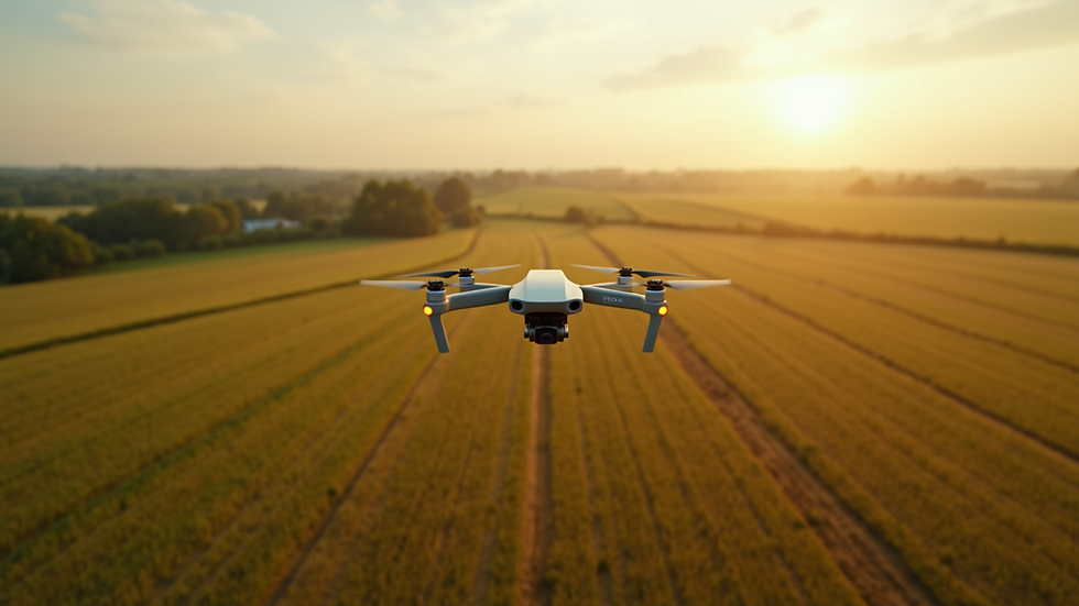
When it comes to showcasing properties in the most captivating way, drone photography has revolutionized the real estate industry. The ability to capture stunning aerial views adds a dynamic perspective that traditional photography simply cannot match. However, understanding the real estate drone photography cost can be a bit complex. In this post, I will walk you through the key factors that influence pricing, how to set your rates, and what you can expect when investing in this cutting-edge service.
What Influences Real Estate Drone Photography Cost?
Pricing for drone photography in real estate depends on several important factors. Knowing these will help you make informed decisions whether you are hiring a professional or offering the service yourself.
1. Property Size and Complexity
Larger properties or those with complex layouts require more flight time and planning. For example, a sprawling estate with multiple buildings will take longer to capture than a standard suburban home. This naturally increases the cost.
2. Location and Accessibility
Flying drones in urban areas or places with strict regulations can add to the price. Permits, insurance, and compliance with local laws are essential and sometimes costly. In Upstate NY, where regulations may vary, this is a critical consideration.
3. Flight Time and Number of Shots
The more shots and angles you want, the longer the drone must stay in the air. This means more battery swaps, data storage, and post-processing time. A simple flyover might be affordable, but a full portfolio of aerial images and videos will cost more.
4. Equipment Quality
High-end drones with advanced cameras produce superior images but come with higher operating costs. Professionals using the latest technology will charge accordingly to cover maintenance and upgrades.
5. Post-Processing and Editing
Raw drone footage often requires editing to enhance colors, correct lighting, and stitch panoramic shots. This editing process adds value but also increases the overall price.
6. Experience and Reputation of the Photographer
Experienced drone photographers with a strong portfolio and positive client feedback can command premium rates. Their expertise ensures high-quality results and smooth project execution.

Understanding Real Estate Drone Photography Cost in Detail
To give you a clearer picture, let’s break down typical pricing structures you might encounter. These examples reflect the market in Upstate NY and similar regions.
Basic Package
Price Range: $150 - $300
Includes: 10-15 aerial photos, 15-20 minutes of flight time, minimal editing
Best for: Small homes, quick marketing shots, simple listings
Standard Package
Price Range: $300 - $600
Includes: 20-30 aerial photos, 30-45 minutes of flight time, moderate editing, basic video clips
Best for: Medium-sized properties, commercial listings, enhanced marketing materials
Premium Package
Price Range: $600 - $1,200+
Includes: 40+ photos, 1+ hour of flight time, advanced editing, 4K video, 3D mapping or virtual tours
Best for: Large estates, luxury properties, detailed construction site documentation
These packages are flexible and can be customized based on your specific needs. For example, agricultural businesses might require detailed crop monitoring shots, while construction companies may want progress tracking videos.
For a more precise estimate, you can explore real estate aerial photography cost to see how pricing aligns with your project scope.

How Much to Charge for Real Estate Photography?
If you are a drone photographer or considering entering this market, setting your rates strategically is crucial. Here are some practical tips to help you determine your pricing:
1. Calculate Your Costs
Include equipment expenses, insurance, licensing fees, travel time, and post-processing hours. Knowing your baseline costs ensures you don’t undercharge.
2. Research Local Market Rates
Check what competitors in Upstate NY are charging. This helps you position your services competitively without undervaluing your work.
3. Consider Your Skill Level
If you are just starting, you might offer introductory rates to build a portfolio. As your expertise grows, increase your prices to reflect your improved quality and efficiency.
4. Offer Tiered Packages
Provide clients with options ranging from basic to premium. This flexibility attracts a wider range of customers and allows upselling opportunities.
5. Factor in Client Type
Commercial clients often have larger budgets than residential sellers. Tailor your pricing to the client’s needs and the complexity of the project.
6. Include Value-Added Services
Offering extras like 3D mapping, thermal imaging, or video editing can justify higher fees and differentiate your business.
By carefully balancing these elements, you can confidently set rates that reflect your value and meet market expectations.
Why Invest in Professional Drone Photography?
Choosing professional drone photography is an investment that pays off in multiple ways. Here’s why it’s worth the cost:
Enhanced Property Appeal: Aerial shots highlight unique features like landscaping, proximity to amenities, and property size. This attracts more potential buyers or investors.
Faster Sales: Listings with drone images tend to sell quicker because they stand out in crowded markets.
Accurate Documentation: For construction and infrastructure projects, drones provide precise progress updates and site inspections.
Marketing Versatility: High-quality aerial photos and videos can be used across websites, social media, brochures, and virtual tours.
Safety and Efficiency: Drones access hard-to-reach areas without risking human safety or requiring expensive equipment.
Investing in professional drone services ensures you get the best results with minimal hassle.
Planning Your Drone Photography Project
To maximize the benefits and control costs, proper planning is essential. Here are some actionable recommendations:
Define Your Goals: Are you showcasing a property for sale, documenting construction progress, or surveying farmland? Clear objectives guide the shoot.
Schedule for Optimal Conditions: Early morning or late afternoon light creates dramatic shadows and vibrant colors. Avoid windy or rainy days.
Communicate with Your Photographer: Share your vision and any special requests upfront to avoid surprises.
Prepare the Site: Ensure the property is clean and accessible. Remove obstacles that could interfere with drone flights.
Review Deliverables: Confirm what you will receive—photos, videos, raw files, edited content—and the timeline for delivery.
By following these steps, you ensure a smooth process and excellent final results.
Elevate Your Visual Storytelling with Expert Drone Imaging
In today’s competitive real estate and construction markets, standing out is essential. Drone photography offers a spectacular way to elevate your listings and projects with breathtaking aerial perspectives. Understanding the real estate drone photography cost empowers you to make smart investments that deliver impressive returns.
Whether you are a business in agriculture, construction, real estate, or infrastructure in Upstate NY, leveraging advanced drone imaging can transform how you present your work and make decisions. With the right pricing strategy and professional execution, drone photography becomes a powerful tool for success.
Ready to take your visual content to new heights? Embrace the future of aerial imaging and watch your projects soar.


Comments