
Unlocking the Potential of Aerial Photogrammetry: How CADi Services LLC Utilizes DJI Terra and Pix4Dmatic for Construction, Agriculture, Surveying, Thermal Scans, and Mining
- camron246
- Jan 27, 2025
- 4 min read
In today's rapidly evolving world, precision and efficiency are essential. Aerial photogrammetry has surfaced as a groundbreaking tool across various industries. With the help of advanced technologies like DJI Terra and Pix4Dmatic, CADi Services LLC is leading the charge in changing how businesses tackle tasks in construction, agriculture, surveying, thermal imaging, and mining. This blog post will take a closer look at the various applications of these innovative software solutions and how they can unlock new opportunities for your projects.
The Power of Aerial Photogrammetry
Aerial photogrammetry captures images from drones or other airborne platforms to create detailed maps and models of the ground below. This method can produce high-quality data critical for informed decision-making in many sectors. CADi Services LLC utilizes drones equipped with high-resolution cameras to efficiently gather aerial images. These images are processed using sophisticated software, providing comprehensive insights.
The combination of DJI Terra and Pix4Dmatic enhances both the accuracy and efficiency of creating 3D models and spatial data. For example, projects can be completed up to 50% faster when using drones compared to traditional ground surveying methods. This integration streamlines the process and provides richer, more detailed information than conventional surveying.
Applications in Construction
In construction, the benefits of aerial photogrammetry go beyond simple mapping. CADi Services LLC uses drone imaging technology to provide up-to-date site surveys, track progress, and create detailed 3D models for effective planning and execution.
With DJI Terra, construction managers can generate orthomosaic maps, which allow them to visualize an entire project area in a single image. This capability lets teams quickly assess sites, identify potential issues, and enhance communication, thus improving overall project outcomes.
For instance, by deploying aerial imagery, CADi Services LLC can help teams reduce material costs by up to 20% through precise volumetric measurements and effective resource management. With Pix4Dmatic, teams can create accurate quantity takeoffs that facilitate timely project completion.
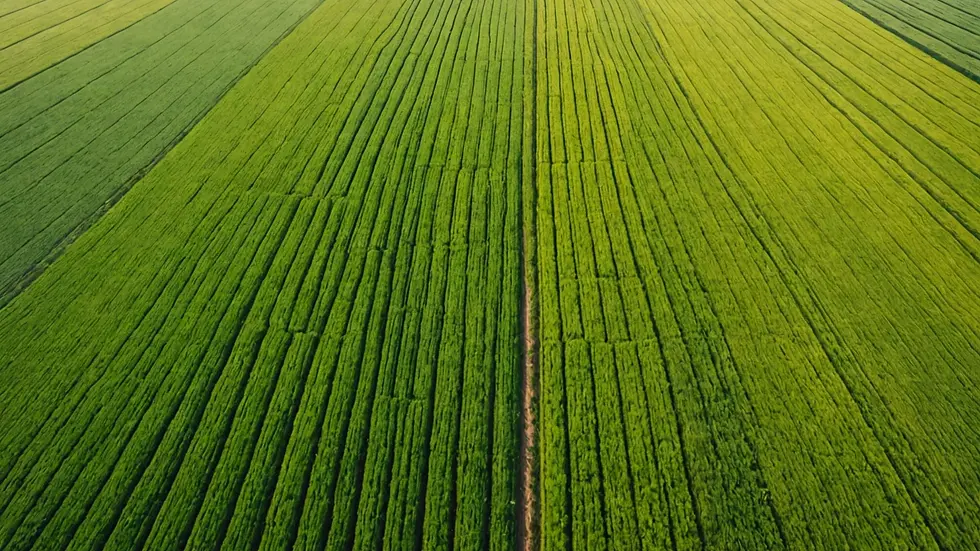
Transforming Agriculture
Agriculture is witnessing significant advancements thanks to aerial photogrammetry. By leveraging drone technology, farmers can access crucial information about their crops that was once hard to obtain. CADi Services LLC employs DJI Terra and Pix4Dmatic to produce prescription maps, monitor crop health, and manage irrigation with greater effectiveness.
For example, utilizing thermal imaging allows CADi Services LLC to assess plant health by detecting temperature variations in crops. This targeted approach enables farmers to optimize yields while minimizing waste. Studies indicate that precision agriculture techniques can improve crop production by as much as 15%, allowing farmers to make informed decisions based on actionable data.
Enhancements in Surveying
Surveying has evolved significantly due to aerial photogrammetry. Traditional methods can be labor-intensive and time-consuming. However, CADi Services LLC is revolutionizing the surveying landscape by using drone-based mapping software to produce high-resolution surveys quickly.
By employing both DJI Terra and Pix4Dmatic, surveyors can cover expansive areas and collect reliable data much faster than before. For instance, using drones can decrease survey times by as much as 70%, making it possible to create detailed topographic maps and 3D models for applications ranging from urban planning to environmental studies.
Moreover, CADi Services LLC guarantees rapid project turnaround times, allowing clients to save valuable time and resources. The precision provided by aerial imaging ensures all relevant site characteristics are accurately captured.
Efficient Thermal Scans
Thermal imaging is becoming increasingly essential for various industries, particularly for identifying inefficiencies or issues. CADi Services LLC employs thermal drone technology to perform comprehensive scans that reveal temperature anomalies in structures or agricultural fields.
By integrating thermal imaging with DJI Terra, CADi Services LLC can swiftly identify energy loss in buildings, malfunctioning equipment, and crop stress. This combination allows businesses to act quickly, mitigating risks and reducing costs. For instance, companies can save up to 30% on energy costs by identifying and addressing energy leaks early.

Innovative Mining Solutions
The mining sector has also experienced the benefits of aerial photogrammetry. Using drones to map mining sites provides a wealth of data that enhances operational efficiency. CADi Services LLC leverages DJI Terra and Pix4Dmatic to create detailed site surveys and volumetric analyses crucial for effective resource management.
By providing accurate volume calculations, CADi Services LLC helps mining operations assess stockpile sizes and manage inventory more efficiently. According to industry reports, businesses that utilize aerial mapping can reduce operational downtime by 25% due to better planning and improved safety assessments.
Moreover, insights derived from drone data assist mining companies in adhering to environmental regulations and sustainably managing their resources. Aerial photogrammetry promotes visibility and accountability in mining projects, supporting responsible practices.
The Future of Aerial Photogrammetry
Aerial photogrammetry is a transformative technology that opens extraordinary possibilities across various sectors. With the integration of powerful software like DJI Terra and Pix4Dmatic, CADi Services LLC is committed to delivering innovative solutions tailored to clients in construction, agriculture, surveying, thermal imaging, and mining.
As industries increasingly embrace drone imaging and photogrammetry, the future looks promising. By harnessing these cutting-edge technologies, businesses can enhance efficiency, ensure safety, and drive growth. CADi Services LLC is leading this charge, committed to helping clients navigate the ever-evolving landscape of aerial photogrammetry and its benefits. Discover the potential today and elevate your projects to new heights.


Comments